ID AND LOCATION
| Stanford #
| 120 |
| AG1980 #
| 120 |
| PM1960 #
| 120 |
| Slab #
| unknown |
| Adjoins
| none |
CONDITION
| Located
| false |
| Incised
| true |
| Surviving
| true |
| Subfragments
| 1 |
| Plaster Parts
| 0 |
| Back Surface
| rough |
| Slab Edges
| 1 |
| Clamp Holes
| 0 |
| Tassello
| no |
TECHNICAL INFO
|
|
|
|
|
|
BIBLIOGRAPHY
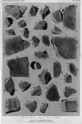
- AG 1980, pl. 38 (N.B. The fragment is incorrectly labeled #122 in AG 1980, pl. 38)
- PM 1960, p. 121, pl. 37
|
|
|
|
|
| ANALYSIS
|
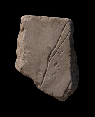
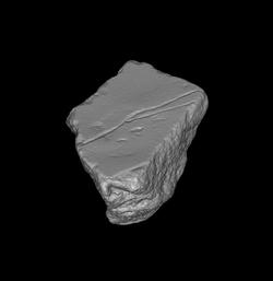
| Description The fragment was part of a slab edge. An uneven line splits into two and they traverse the entire fragment. A straight line, almost parallel to the two uneven ones, is visible to the far right (N.B. This line is missing from AG 1980, pl. 38, and is barely visible in PM 1960, pl. 37).
Identification: Stream? Aqueduct? The uneven nature of the forked lines is highly unusual on the Plan (a line in fr. 165abd is somewhat similar), and it might suggest they represent a feature not made by man, such as the edge of a river or perhaps a small stream. It is also tempting to associate the lines with an underground aqueduct. Both theories are unlikely, however: The engravers of the Plan did not include anything non-architectural; even the edges of the Tiber were omitted. And most of Rome's underground aqueducts would presumably have been covered with construction by the time the Plan was carved, and they would therefore not have been included in the Plan. The straight line to the right probably depicts the wall of some large enclosure.
Significance If the uneven lines in this fragment indeed represent a natural feature on the great map, such as a stream, they would be unique. |
|
| HISTORY OF FRAGMENT |
| Like the majority of FUR fragments, this piece was discovered in 1562 in a garden behind the Church of Saints Cosmas and Damian. From here, it was transferred to the Palazzo Farnese and stored there. The fragment was later used as building material in the 17th-c. construction of the Farnese family's Giardino Segreto (Secret Garden) near the Via Giulia, and was rediscovered in 1888 or 1898 when the walls of the garden were demolished. Since then, it has been stored with the other known FUR fragments in various places: the storerooms of the Commissione Archeologica (1888/1898-1903), the Antiquarium Comunale (1924-1939), the Capitoline Museums (1939-1955), the Palazzo Braschi (1955-1998), and since 1998 in the Museo della Civiltà Romana in EUR under the auspices of the Sovraintendenza ai Beni Culturali del Comune di Roma. (This fragment's history corresponds to Iter E'' as summarized in PM 1960, p. 56.) N.B. PM 1960 does not reveal the whereabouts of the fragment between 1903 and 1924.
Text by Tina Najbjerg
|
|
| KEYWORDS
|
| stream, river, aqueduct |
|