| [FRAGMENT ANALYSIS IN PROGRESS]
Description
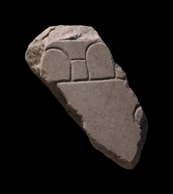
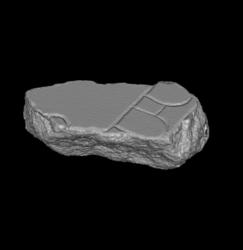
Top of fragment has two half-ovals with dash connecting them, probably representing the arches of an aqueduct. The lower part of the fragment has no features except for a circular incision on the right edge.
Identification: match with fr. 37Bbcd
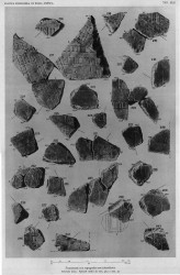
On plate 42 of PM 1960 fragments 37Bbcd are connected to 37Be on the lower right side, showing a continuation of the aqueduct.
Identification: part of Aqua Alsietina
Rodríguez-Almeida identified this fragment together with some others, as part of the Aqua Alsietina, the aqueduct that was located on the right side of the Tiber and that came from Lake Alsientinus to the north of Rome. He argued that one section of the Aqua Alsietina, depicted in fragment group 37Bbcd and 37Be, is shown in sideview while another part, on frs.37Bfg and 37Cabc, is seen both in groundplan and from the side.
Although little is known about the real course of this aqueduct, the section depicted in frs.37Ba, 37Bbcd, 37Be and 37Bfg must be located somewhere in Trastevere, near the horrea Lolliana and fr. 37Cabc precisely below this area on the map.
Identification: part of Aqua Alsietina
Taylor discusses the specific course of the Aqua Alsietina and positions fragment group 37B approximately 0.5m to the right within slab IV-8, and reorients the fragments to match the course of the actual channel better. The author also considers the depiction of these aqueducts on the Plan, noting that the arched symbols might even represent millwheels, as the water channels may have accommodated millraces to serve the flour mills on the Janiculum.
Significance
The difference between the representation of the aqueduct in this fragment and other fragments demonstrates that the engravers sometimes employed ad hoc solutions when depicting the topography of the Marble Plan: while the aqueduct on fragment 517a-f is seen from above, as is common for architecture on the FUR, long stretches of the Alsietina crossed open spaces and there was thus room to depict it in elevation view and make it instantly recognizable as an aqueduct (AG 1980, pp. 144-45; Reynolds 1996, pp. 67-69). Ascertaining the use of different designs for different aqueducts helps us understand the symbolic language of the map.
|