| [FRAGMENT ANALYSIS IN PROGRESS]
Description
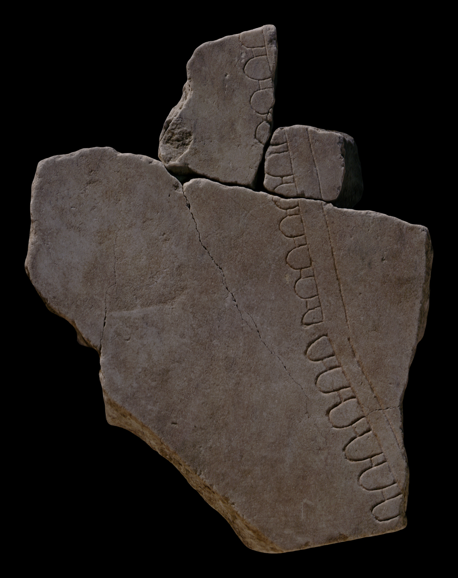
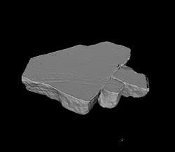
Three attached fragments: the largest piece is 37Ca, 37Cb is located above 37Ca on the left and 37Cc on the right. The lower side of 37Ca has an original slab edge.
The three fragments show a road running top to bottom with a slight right angle. On the lower part of 37Ca the road curves to the right. The road is flanked on the left by a series of half-oval structures connected by a dash. These represent the arches of an aqueduct. There are no other features on this map, the road and aqueduct are located in an open space.
Identification: part of Aqua Alsietina
Rodríguez-Almeida identified this fragment together with some others, as part of the Aqua Alsietina, the aqueduct that was located on the right side of the Tiber and that came from Lake Alsientinus to the north of Rome. He argues that one section of the Aqua Alsietina
, depicted in fragment group 37Bbcd and 37Be, is shown in sideview while another part, on frs. 37Bfg and 37Cabc, is seen both in groundplan and from the side.
The different thickness of frs. 37Bfg and 37Cabc indicates that they were distributed over two different slabs. Although little is known about the real course of this aqueduct, the section depicted on frs. 37Ba, 37Bbcd, 37Be and 37Bfg must be located somewhere in the Trastevere, near the horrea Lolliana on slab IV-8. Fr. 37Cabc was directly below this area on slab III-16.
Identification: part of Aqua Traiana
Taylor argues that the orientation of the specus on fragment 37C is observed to match the Aqua Traiana, and 37Cabc is thus moved into slab III-18, two slabs to the right of Rodriguez-Almeida's original positioning of the Alsietina. The author also considers the depiction of these aqueducts on the Plan, noting that the arched symbols might even represent millwheels, as the water channels may have accommodated millraces to serve the flour mills on the Janiculum.
Identification: part of aqueduct
Tucci has re-examined the courses of the aqueducts and Almeidas reconstruction of the fragments, which is based on his conviction that the Plan represents underground as well as above ground sections of the aqueducts. In Almeidas proposed reconstruction the border of the 37Cabc group coincides with the lower edge of a vertical slab (on slab III-16, fig 3), but Tucci indicates that this lacks any connection to the actual outline of the aqueducts in this region. Tucci argues however that frs. 37Cabc should be turned over and located much lower, on the upper edge of slab I-20. The arches of the aqueduct would thus flank the left side of the Via Aurelia (towards Rome).
Significance The difference between the representation of aqueducts demonstrates that the engravers sometimes employed ad hoc solutions when depicting the topography of the Marble Plan: while the aqueduct on fragment 517a-f is located in dense urban structure and depicted as seen from above, as is common for architecture on the FUR, fragment 37Cabc shows a stretch of an aqueduct crossing an open space. Here there was room to depict the architecture in elevation view and to make it instantly recognizable as an aqueduct (AG 1980, pp. 144-45; Reynolds 1996, pp. 67-69). Ascertaining the use of different designs for different aqueducts helps us understand the symbolic language of the map.
|