| [FRAGMENT ANALYSIS IN PROGRESS]
Description
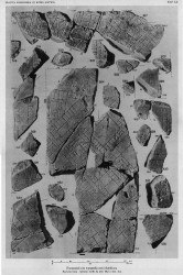
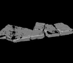
Six attached fragments, 517a is in the left corner and connects on the right side to 517b, c and d. 517e and f are connected to the lower part of 517b and c. Frs. 517a-d form an original slab edge. 517a has also another original edge and is thus the corner of a slab. On PM plate 52 a part of a clamphole is indicated between 517b and c but this is difficult to see on the scanned image.
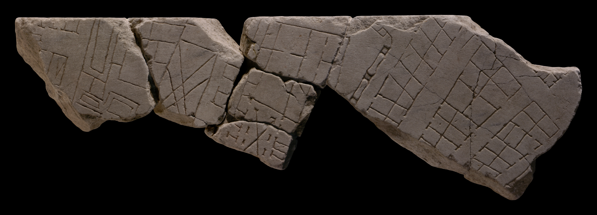
Joined fragments show six blocks crossed by several streets and alleys. In the upper left corner a row of tabernae is visible flanking an open area or a wide street running top left to bottom right. The back of two more spaces (one with staircase) are visible on the opposite side of this street or open area. A cross street runs top-down on the right side of the buildings. This street is flanked on the right by a building or collection of buildings with several long and rectangular rooms. Three spaces have interior lines that may represent a pool or garden area. On the right side a large rectangular space is visible with a double cross through the middle. A small road or alley runs top right to bottom left to the right of these buildings, flanked by a third block of buildings. This block has a row of small rooms on the left, an alley, and a new row of small rooms, this time facing three long rectangular spaces. The upper two spaces are connected by a doorway. More rectangular rooms are visible to the right, but no visible doorways. The lower part of this block consists of an open area with an arcade on two sides and a cross through the middle. This space has small rooms on either side, one with an internal staircase. A wide street runs top right to bottom left to the right of this block, probably crossing another road running left to right. In the middle of the wide street an aqueduct is indicated, that curves into the cross street in the upper part of the fragment. On the other side of the street two rows of back-to-back single rooms are visible, possibly tabernae, although not all rooms have entrances indicated. To the right of this block two street and two similar blocks of back-to-back tabernae, but of more irregular shape are indicated. The start of a new block is visible on the top right corner of the fragments. In the lower left corner of the fragments a slightly concave line and a small rectangle indicate the presence of a new architectural feature.
Identification: two aqueducts outside the Esquiline Gate
Rodríguez-Almeida reconstructed the two square blocks with rounded edges and united by a segment with a slight concave in the lower right corner of the fragments as two pillars of a second aqueduct. By comparison with the actual course of aqueducts in Rome, he hypothetically places these fragments toward the upper left corner of the Plan, i.e. outside the Esquiline Gate, in the area of the Termini station.
Identification: closing wall of Forum Trajanum
Tucci argues that the fragments should perhaps be placed in the lower left corner of slab V-9 (with the Basilica Ulpia, see fig 4). The fragments of this slab are identical in terms of thickness, finish and fracture lines. The architectural feature that is visible in the lower right corner of the fragments (identified as a second aqueduct by Almeida), could also be a closing wall. Similar square blocks are for instance visible on fr.39f (with the Temple of Venus Victrix and on fr.8fg (around the Circus Maximus. This closing wall could represent the northern limit of the Forum Trajanum (see fig 5).
Significance This fragment shows the urban fabric in the area north of the Forum of Trajan.
The difference between the representation of the aqueduct in this fragment and the Aqua Alsietina demonstrates that the engravers sometimes employed ad hoc solutions when depicting the topography of the Marble Plan: while the aqueduct on fragment 517 is seen from above, as is common for architecture on the FUR, long stretches of the Alsietina crossed open spaces and there was thus room to depict it in elevation view and make it instantly recognizable as an aqueduct, see for instance fr.37Cabc (AG 1980, pp. 144-45; Reynolds 1996, pp. 67-69). Ascertaining the use of different designs for different aqueducts help us understand the symbolic language of the map.
|