| [FRAGMENT ANALYSIS IN PROGRESS]
Description
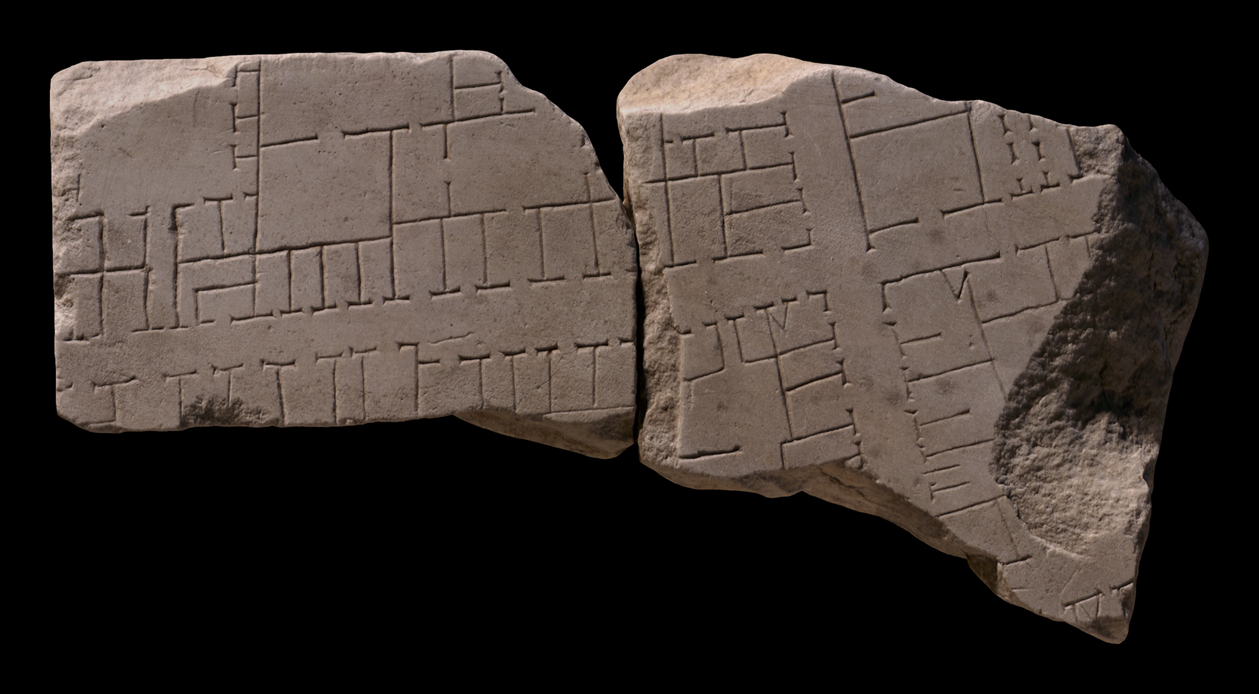
Two joined fragments, 574a is the lower right corner of slab and has two original edges. 574b joins 574a on the left.
Slightly curved street runs left to right through the middle of the two fragments and is intersected by a perpendicular street towards the left. A third possible street is visible in the left top edge of the fragment, running left to right.
Below this street a cluster is visible on the left with buildings with several rooms and entrances, the (right) corner one of which has a staircase. The cluster opposite on the right has tabernae on the two visible sides along the streets and possibly a popina (#link) in the bottom left corner. The tabernae towards the right are slightly longer, thereby narrowing the street. A corridor provides access to a court in the top right part of this cluster.
The bottom left cluster has a double arcaded building in the left corner, possibly carrying two roofs with an open area in the middle (?). Two larger buildings are also visible on the right side of this cluster.
The cluster on the bottom right is long and rectangular with tabernae flanking the streets. Larger rooms with multiple access points are visible in the middle of the block and in the right corner an alley or corridor provides access to a large open area flanked by tabernae (acc to Tucci perhaps a spacious house with atrium, 2004, 194).
Identification: warehouses and commercial space near the Via Campana-Portuensis
Tucci places the fragments on the right bank of the Tiber opposite the Aventine, on slab IV-7 (Tucci 2004, fig. 2). This is the area of the Ospizio Apostolico di San Michele, near Porta Portese. These fragments are joined by Tucci to 138a, 138bcde and
138f based on smoothness of the back and thickness of the slab.
The street running through the middle of the fragment corresponds with the modern Via San Michele according to Tucci (fig. 5-6). The possible road in the top left corner could be a continuation of the Via Campana-Portuensis. However, Tucci finds it more probable that it ran straight from slab IV-8 (fig.5-6), locating it above fragments 574ab.
Significance
In this fragment no monumental buildings are represented, instead it provides a view of the lesser known structures that made up the urban fabric of Rome: commercial and possibly industrial buildings in the vicinity of the ports on the right bank of the Tiber.
|