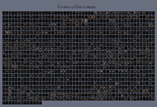
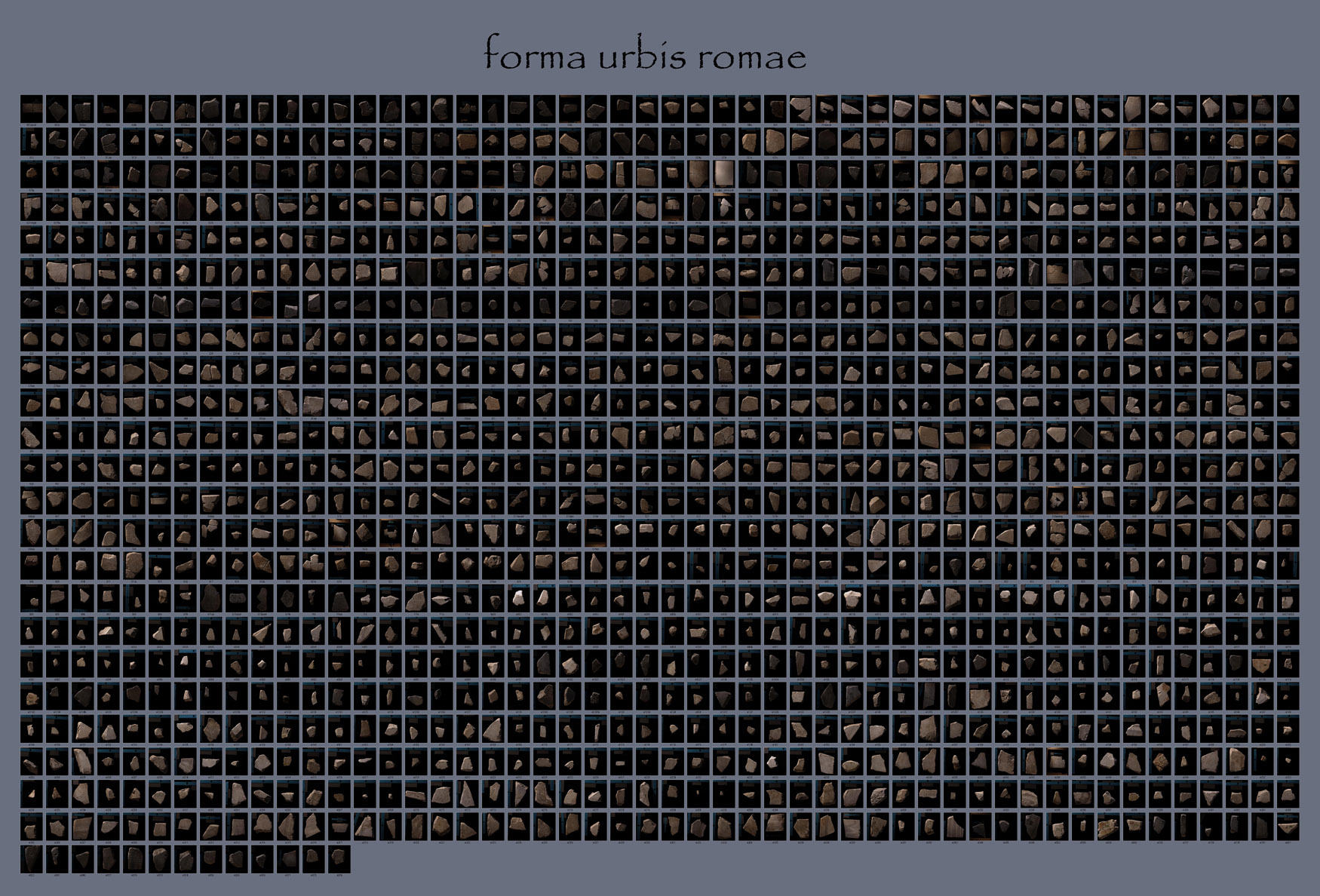
 Collage showing 1,163 FUR fragments Click here for a 1750 x 1188 pixel (598 KB) or 3500 x 2376 pixel (2.2 MB) version. |
INTRODUCTION: A KEY ARCHAEOLOGICAL RESOURCE--IN 1,186 PIECES The Forma Urbis Romae (or Severan Marble Plan) is a crucial resource for studying the ancient city of Rome. Enormous in size and astonishingly detailed (see The Map), it contains irreplaceable information about the city in the early 3rd c. CE--its famous monuments and its lesser-known neighborhoods, its major streets and its back alleys, its commercial infrastructure and its religious life. The Plan also tells us about ancient Roman ideas of the city, ideologies of representation, and mapping and surveying. The more we know about the Marble Plan, the more we know about imperial Rome. Unfortunately, only 10-15% of the Plan survives--and in 1,186 pieces. Starting in the 4th c. CE, this map suffered the same fate as many other public monuments in the city of Rome. Many of the slabs onto which it was carved were simply stripped from the wall of the Templum Pacis on which it was mounted and used in the construction of new buildings, or burnt in kilns to make lime. Even after the Plan's rediscovery in the 16th c. CE, pieces of it were used as construction material and lost. (See History of the Plan.)
|
Stanford's Digital Forma Urbis Romae Project is addressing these challenges by means of a collaboration between computer scientists and archaeologists. Our primary technological aim is to develop 3D matching algorithms and "solve the map." Archaeologically speaking, we are working to understand this monument in new ways and to make the Forma Urbis Romae accessible to a wide audience of scholars, teachers, students and interested members of the public.
TECHNOLOGICAL GOALS: SOLVING THE MAP WITH 3D MATCHING
The idea of using laser scanners and computer graphics to visualize the fragments of the Forma Urbis was first suggested to us in January of 1997 by Susanna Le Pera of the Archeological Superintendency of Rome. The idea of using computer algorithms to also piece the map together the map was our own idea, but it was naive. We initially thought that it would be a simple matter to search among digital photographs of the fragments for matches between their border shapes or the incised designs on their top surfaces. Unfortunately, these top surfaces are often eroded, reducing the effectiveness of such an approach. Moreover, scholars have spent 500 years searching for matches among these incised designs; it seems unlikely that we will find many more. On the other hand, the fragments are several inches thick, and fragments that do fit together usually mate intimately across at least a portion of the interface surface between them. Our idea, not yet tested, is to develop compact signatures for these border surfaces and to search among the signatures for matches.We believe that the best hope for piecing the map together lies in using computer shape matching algorithms to search for matches among the fractured side surfaces of the fragments. In order to test this idea, we need 3D geometric models of every fragment of the map. To obtain this data, during June of 1999 a team of faculty and students from Stanford University spent a month in Rome digitizing the shape and surface appearance of every known fragment of the map using laser scanners and digital color cameras. (see photo essay on Scanning the Fragments). Thanks to Laura Ferrea of the Superintendency in Rome, 23 additional fragments, excavated in 1999, traveled to Stanford in the spring of 2001 and were photographed and scanned. Our raw data consists of 8 billion polygons and 6 thousand color images, occupying 40 gigabytes.
The technological goals of the Digital Forma Urbis Romae Project are threefold: to assemble our raw range and color data into a set of 3D (polygon mesh) models and high-resolution (mosaiced) photographs - one for each of the 1,186 fragments of the map, to develop new shape matching algorithms that are suitable for finding fits between 3D models whose surfaces are defined by polygon meshes, and to use these algorithms to try solving the puzzle of the Forma Urbis Romae. Whether or not we succeed in solving the puzzle, one of the tangible results of this project will be a web-accessible relational database giving descriptions and bibliographic information about each fragment and including links to our 3D models and photographs. Our long-term plan is to make this archive freely available to the archeological (and computer graphics) research communities, educators, museum curators, and the general public.
An important secondary goal of this project is to explore the scientific utility of detailed three-dimensional computer models. For the art historian or archaeologist, 3D models provide a tool for answering specific geometric questions about artifacts. Trying to solve the jigsaw puzzle posed by the Forma Urbis is one obvious example. To find out more about the technological side of the Project, go to Forma Urbis Romae at Stanford Graphics.
ARCHAEOLOGICAL GOALS: NEW WAYS OF SEEING THE PLAN AND THE CITY
Rome at its height was the capital of the largest of the ancient empires; with a population of estimated at 1,000,000 between ca. 100 BCE and 200 CE, it was also the largest city the world had yet seen. Understanding this megalopolis--how it grew so large and why, how it sustained itself, what life was like there in light of major historical developments--is a significant issue for historians and archaeologists. A key source of evidence with which to tackle these questions is the Severan Marble Plan of Rome; its importance and interest drive the Project's archaeological goals.Our first aim is to create a widely-accessible and fully searchable tool for research and study, the Database. Access is important because the monument itself is challenging to work with; its fragments are numerous, often very heavy, and always fragile. (The curators of the Capitoline Museum are currently working on ways to exhibit the Forma Urbis Romae in full; in the meantime, the fragments are in storage at the Museum of Roman Civilization and scholars may apply in writing for permission to see and work with them.) Existing publications address the problem of access, but only for specialists who work in research libraries; PM 1960 was only published in 400 copies, and AG 1980 is difficult to find outside Italy.
Our second aim is to present the best and most up-to-date information about the Plan. The Digital Forma Urbis Romae Project represents the first systematic and computer-aided attempt to reconstruct the surviving portions of the Marble Plan (see above). Any new matches will provide new information about the Plan and the imperial city, and will need to be communicated speedily. Already, the Project's color photographs and 3D models constitute the best representations of the fragments in existence. They supplement and often surpass the black and white photographs published in PM 1960 and the analytical drawings published in AG 1980. Viewers can rotate 3D models of individual fragments, zoom in and out, and change the lighting to study all sides of a fragment and its incisions in detail. The accompanying text provides analytical descriptions of each fragment and a synthetic overview of the latest scholarly research. The Project's data also include photographs and models of the blank fragments, which have never been published, and, thanks to the work of Laura Ferrea of the Sovraintendenza, the 23 fragments excavated in 1999.
Our third goal is to propel research on the Forma Urbis Romae in significant new directions. Technological innovations in the Humanities allow us not just to do existing kinds of research better, but also to envision new ways of thinking with our material, new questions to ask of it and new means of obtaining answers. This Project's collaboration between archaeologists and computer scientists is sparking new ways of seeing and thinking about the Marble Plan of Rome. Scholarship on this monumental artifact, with few exceptions (most notably Reynolds 1996), has focused above all on locating and describing major buildings in the imperial city. Having accessible and three-dimensional data to work with now allows us to explore other avenues of research as well. We are interested in what the Marble Plan can tell us about graphic representation, civic ideology, the layout of the city and movement through its streets, the interactions of monumental, commercial and residential space, the formation and microfabric of neighborhoods, and the study of urbanism and mapmaking in Rome and well beyond.
For information on how to cite from this text, click here.
Copyright © 2002-2016 The Stanford Digital Forma Urbis Romae Project