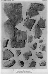
| [FRAGMENT ANALYSIS IN PROGRESS]
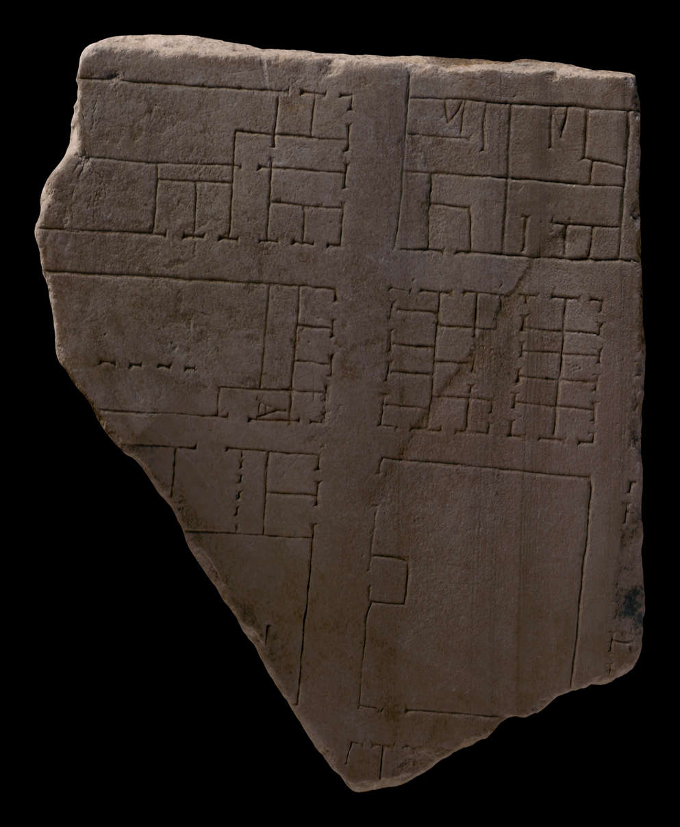
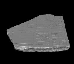
Description Four attached fragments, 138d in the top left connects to 138b on the right; 138c in the bottom right connects to 138e in the bottom left. Fragments 138c-e form the lower-left original corner of the slab. Two modern metal pins connect 138b to 138a. The breakage of the four fragments is possibly the result of a sledge impact, as experimented by the Stanford Forma Urbis team (see
photo essay).
The lower part of the slab shows strong veining running right to left. A clamphole is visible in the bottom left corner, on the side of fragment 138e.
On the bottom edge, a rectangular area has been chiseled away to accomodate the clamp from the adjoining slab. Only frs. 1a and b-e,
10g,
28c,
31dd,
138c,
329,
338, and
604
display a similar mark (generally on the bottom edge of the slab?).
Joined fragments show a wide street running left-right, as well as a parallel narrower street on the lower half of the fragments. Both are intersected by two perpendicular streets on the right and left edge of the fragments. At the top a large open area is visible with an external staircase (leading down?, similar staircases are visible on fr 27b#) which connects to 92 and on the right a building with two rows of columns in a court. The latter continues on fragment 138a and possibly on 92, forming a large building with an open court surrounded by one-room buildings, extending to the bank of the Tiber.
Below the wide street is a large rectangular cluster with tabernae flanking the street, as well as a large space with an arcade on the right side, possibly carrying a roof. The lower part of this block has several one-room buildings with stairs and larger (open?) areas, possibly insulae.
The bottom part of the fragments also has a large rectangular cluster with several unidentified larger buildings and six tabernae flanking the street on the right. The left corner of this cluster has a large space with two wide entrances.
Identification: the Via Campana-Portuensis
Tucci places fragments 138a-f on slab IV-8 on the right bank of the Tiber, opposite the Aventine, based on the size of the fragments and the location of the clamp holes (see Tucci 2004, fig. 1-2). This area at present houses the Ospizio Apostolico di San Michele (Tucci 2004, fig. 5-6). He identifies the wide street as the Via Campana-Portuensis. The combined fragments 138a-f show that the direction of this road was closer to the river than originally projected. There are two possible routes for the extension of the Via Campana-Portuensis into slab IV-7, the first bending towards the river in the right part of the slab, the second heading more straight (Tucci 2004 fig. 5 and 6). Tucci finds the latter more probable, where it would possibly lead to the Pons Sublicus. It is not certain whether the road is identical with the 1st c AD Via Portuensis. The narrower street on the bottom half of the fragment corresponds with the modern Via San Michele.
The Via Campana ran from the Pons Sublicus through the Transtiberim to the mouth of the river. Patterson in LTUR notes that the route was important for provisioning the city. The Via Portuensis was perhaps built in the first c AD in order to improve traffic between the new harbor of Claudius at Portus and Rome (Patterson in LTUR). Its route within the city was the same as that of the Via Campana. The road shows up on several FUR fragments: 28a and 138a.
Identification: river front warehouse space The fragment shows a stretch of flat land (characterized by regular layout of streets and buildings) on the right bank of the Tiber. This part of the ancient city held commercial and industrial buildings related to port activities. The buildings on the upper part of the fragment are closer to the river and different in function than the tabernae and houses further down on the fragment. This corresponds with the fragments 28a, 28b, 28c, 25a, 25b,
27f, (24a?, 24b-d?) where large spaces possibly represent warehouses or industrial areas.
Significance This fragment shows the urban fabric on the right bank of the Tiber and the high degree of industrial and commercial buildings related to port activities and its connection to main thoroughfares to and from the city, such as the Via Campana-Portuensis.
|