ID AND LOCATION
| Stanford #
| 32cde |
| AG1980 #
| 32c-e |
| PM1960 #
| 32 c-e (e=560) |
| Slab #
| V-13 |
| Adjoins
| 32b 32f |
CONDITION
| Located
| true |
| Incised
| true |
| Surviving
| true |
| Subfragments
| 3 |
| Plaster Parts
| 0 |
| Back Surface
| smooth |
| Slab Edges
| 0 |
| Clamp Holes
| 0 |
| Tassello
| no |
TECHNICAL INFO
|
|
|
|
|
|
BIBLIOGRAPHY
- AG 1980, pp. 115-18, pls. 24, 55
- LTUR III: Aesculapius, Aedes, Templum (Insula Tiberina)(D. Degrassi), pp. 21-22
- LTUR III: Insula Tiberina (D. Degrassi), pp. 99-101
- LTUR V: Tiberis (M. Maischberger), pp. 69-73; Vicus Censori (D. Degrassi), p. 157
- PM 1960, pp. 93-4, 149, pls. 13, 30, 54
- Richardson 1992, pp. 3-4 (Aesculapius, Aedes); pp. 209-210 (Insula Tiberina); pp. 398-99 (Tiberis); p. 422 (Vicus Censori)
- Rodríguez-Almeida 1992
|
|
|
|
|
| ANALYSIS
|
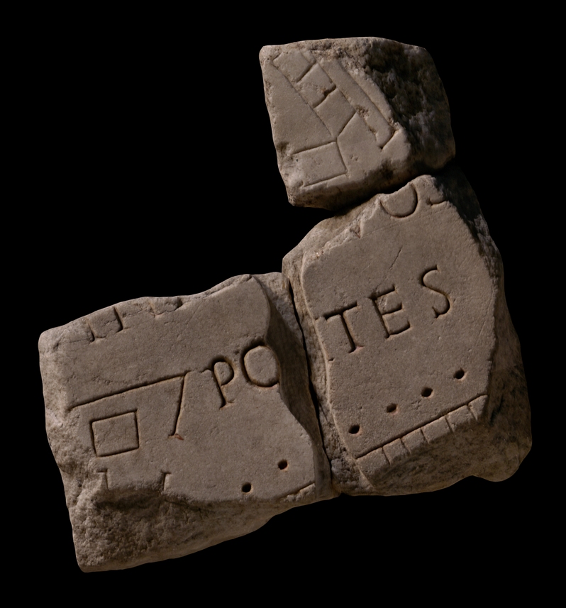
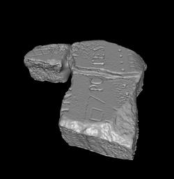
| Description A row of rooms, fronted by a colonnade, is visible below the horizontal inscription that traverses the fragments. Left of the inscription, a V-shaped enclosure with an opening in the right side frames a small rectangular feature. Top right, a rectangular feature joins at an oblique angle the corner of three rooms in a row. These rooms back onto a long, narrow feature.
Identification: Insula Tiberina L. Cozza was able to match frs. 32c and d to the now lost fr. 32b, and, during the printing of PM 1960, to frs. 560 and 549 which were renamed 32e and 32f (hence the dual appearance of these in PM 1960, pls. 30 and 54). The combination allowed Cozza to identify the pieces as belonging to the area of Tiber Island where the two bridges, the Cestius and the Fabricius, met (PM 1960, p. 93). The island was referred to in antiquity as the insula Tiberina, insula Tiberis, isula Tiberini, insula Aesculapi, or simply insula (LTUR III, p. 99). Part of one of these labels is visible in fr. 32a. Despite its importance in Rome's earliest history, when it was the only point at which the treacherous Tiber could be crossed by a ferry, the tiny island is not mentioned in ancient sources until the 3rd c. BCE, when it became the site of the imported cult of Aesculapius. Its use as a center of healing continued through the Middle Ages to this day. Even before the 1st c. BCE the island was surrounded by stone foundations to give it the shape of a ship. Remains of the travertine "stern", with a serpent coiled around a staff carved in relief, are still visible on the SE tip. Systematic construction on the island, which was located in the 14th Augustan region, seems to have begun in the 1st c. BCE with the rebuilding of the Temple of Aesculapius and the construction of the two stone bridges, the Fabricius (62 BCE) and the Cestius (mid-1st c. BCE), on either side (LTUR III, p. 100). The evidence provided by the now missing fr. 32b and 32e suggests that the structures above the inscription in these fragments consisted of a triangular courtyard, surrounded by rows of rooms. They were perhaps connected to the sanctuary of Aesculapius which is believed to have been located on the SE end of the inland (LTUR III, p. 100, fig. 62). The elongated feature behind the rooms to the right may represent part of the stone edge that was constructed around the island to give it the form of a ship. This is supported by the fact that the feature makes a slight curve inward in fr. 32f.
Identification: Vicus Censori
Although the open space between the two bridges looks more like a piazza than a street, it may represent the vicus Censori, the only vicus known to have existed on the island (LTUR V, p. 157). The colonnade that frames the NW edge of the space heightens the impression of an important thoroughfare. The small structure framed by a V-shaped enclosure perhaps represents a shrine to one of the many deities known to have had a cult on the island, such as Faunus, Semo Sancus Dius Fidius, Tiberinus and Gaia, or Bellona Insulensis. A likely candidate is the Lares Augusti, dedications to whom were discovered in the island's central piazza in the 17th c. (LTUR III, p. 100).
Identification: Tiberis L. Cozza's ability to join these fragments with fr. 32f demonstrates that the blank area to the right of the elongated, narrow feature in fr. 32e represents the Tiber. Italy's third longest river, the Tiber winds its way through Rome about 25 km before it drains into the Tyrrhenian Sea. In antiquity, only Tiber Island and perhaps eight bridges interrupted its 5.6 km long stretch between the Aurelian Walls. For the Romans, the Tiberis (other appellations were Albula, Thybris and Tiberinus) was a provider of both bounty and frustration. It was the vital trade route between the city and the outside world; fishing in its waters provided food; and until the construction of Rome's aqueducts, it was the major source of drinking water. However, the Romans struggled endlessly to keep the waterway navigable and to control the violent and frequent floods. Commercial buildings such as horrea were constructed along its banks as early as the 2nd c. BCE., and later the villas, horti, and mausolea of the upper class vied for space along the river with the apartments and cemetaries of the less fortunate. Remains of these buildings, especially of the commercial structures and the cemetaries and residences of the poorer classes, were largely destroyed when retaining walls were constructed on both sides of the river at the end of the 19th c. (It was during the construction of the Tiber embankment along the Via Giulia in 1888 or 1898 that a great quantity of FUR fragments were discovered.) The appearance of these structures on the Marble Plan is therefore of great importance.
Despite its nodal role in Rome's economy and social and political history, the Tiber is not outlined on the Marble Plan. It appears as a blank space whose shape is only discernible because it is framed by constructions on both sides (see for example fr. 24d. Although color was used to highlight certain buildings and streets on the Plan, the river does not seem to have been emphasized - apart from a possible label, Tiberis, in fr. 200b (Rodríguez-Almeida 1992, pp. 59-60).
Significance The inscription in frs. 32c and d was key to identifying them and frs. 32b and f as belonging to the Tiber Island. Frs. 32e and f provide a view of the wall or foundation that was constructed around the island to give it the shape of a ship; today, only a short stretch of this wall is visible along the SE tip. All three sub fragments are broken along parallel lines, characteristic of pieces belonging to slab V-13 (AG 1980, pp. 115-118 and pl. 24). |
|
| HISTORY OF FRAGMENT |
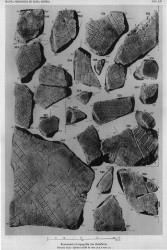
| Along with the majority of the fragments, these three pieces were discovered in 1562 behind the Church of Saints Cosmas and Damian. From here, they were transferred to the Palazzo Farnese and stored there. Renaissance engravers reproduced fragments 32c and d in 16th c. drawings that are now kept in the Vatican (Cod. Vat. Lat. 3439), and Giovanni Pietro Bellori included them in his 1673 publication. The present state of conservation indicates that these two fragments broke some time thereafter. In 1742, they were moved to the Capitoline Museums and exhibited with other known FUR fragments in wooden frames along the main staircase. In 1903 museum curators included the pieces in a reconstruction of the FUR mounted on a wall behind the Palazzo dei Conservatori (1903-1924). After its initial discovery in 1562, fr. 32e was used as building material in a 17th c. Farnese construction, the Secret Garden, and it was rediscovered in 1888 or 1898 when the walls of the garden near the Via Giulia were demolished. Until 1903, it was kept in the storerooms of the Commissione Archeologica. PM 1960 does not indicate the whereabouts of the fragment between 1903 and 1924. Since 1924 it has been in storage together with frs. 32c and d and all other known FUR fragments in the Antiquarium Comunale (1924-1939), the Capitoline Museums (1939-1955), the Palazzo Braschi (1955-1998), and since 1998 in the Museo della Civiltà Romana in EUR under the auspices of the Sovraintendenza ai Beni Culturali del Comune di Roma (The history of these fragments corresponds to Iter B [fr. 32cd] and Iter E'' [fr. 32e] as summarized in PM 1960, p. 56).
Text by Tina Najbjerg
|
|
| KEYWORDS
|
| Tiber, island, colonnade, vicus, courtyard, sanctuary, bridge, river |
|